Geotrek National Days 2026
May 2026
From June 3 to 5, 2026, the Geotrek community will gather in Millau, France for the 2026 Geotrek National Meetings, three days dedicated to sharing experiences, discussing Geotrek use cases and discovering the latest developments of the solution.

Focus on Geotrek's Sensitivity module
June 2024
Created in 2018 and designed by the LPO Isère, this module allows:
- to finely manage regulatory zones and sensitive zones in Geotrek,
- to provide information on the areas of biotope protection orders: location, regulation period, associated description, species, typology of practice, etc.,
- to automatically connect all nearby Geotrek objects..

New on Geotrek-widget !
May 2024
Discover the latest brick to arrive in the Geotrek ecosystem: the Geotrek-widget, designed to boost the promotion of outdoor activities on the website of your choice!
The widget is a simple solution for territories that already have a website and wish to promote content from Geotrek without deploying a dedicated site.
It provides a smooth user experience, promoting engagement and strengthening your online presence.

Geotrek expands its editorial section !
April 2024
-
Enrich the editorial section of Geotrek-rando
-
Allow you to build a multi-level, richer and more complete navigation menu
-
il enrichit Simplify, clean and enrich static pages (pre-defined styles, image loading, responsive, content suggestions, linked pages, etc.)

Manage and promote outdoor activities with the Outdoor module!
March 2024
Manage and promote outdoor activities with Geotrek? It's possible !
Climbing, Paragliding, Diving, Canyoning, Sailing, Orienteering and much more...

Geotrek-widget
February 2024
What if we told you that entering a hike just once so that it can then be broadcast on Cirkwi, IGNrando', Apidae, Visorando or Outdooractive is possible?
Welcome to the Geotrek ecosystem!

The power of community and open source: how Geotrek endures over time!
January 2024
Geotrek has existed for more than 10 years but still remains the most popular tool for parks and natural spaces to manage and promote outdoor activities! Today, let's discover the world of open source and how Geotrek has met the challenge of surviving thanks to the commitment of its community.
What is the Open Source Community? The Open Source community is a dynamic collaboration of voluntary contributors and structures sharing a common passion for the development of free software and the desire to develop the project collectively. It is an ecosystem where transparency, collaboration and innovation are at the heart of every project!

Geotrek wins an OSOR Awards 2023
November 2023
The OSOR awards brought together European free software actors on Tuesday, November 21, in Brussels. The opportunity to reward public initiatives in the area of free software. Geotrek, the Open Source application for managing and promoting hiking developed by a consortium of French public partners, received the jury award in Brussels.

Geotrek, voted best initiative by the OSOR Awards 2023 jury
Geotrek, was named winner by the OSOR Awards jury in the category of best open source initiatives in the European public sector, among 92 participants and 6 finalists in a competition organized by the Open Source observatory of the European Commission. The other finalists are French (demarches-simplifiees.fr, supported by the French government), Spanish, Danish and Italians.
The Geotrek widget is evolving
November 2023
The Haut-Jura regional natural park and Makina Corpus financed a first version of the Geotrek-widget in 2022, announced on the mailing list.
The Loire-Anjou-Touraine regional natural park has just financed a series of changes to the widget to improve both its display and its content, which is now closer to Geotrek-rando with:
- The enhancement of information on treks
- The addition of multi-days treks, touristic contents and events
- The modernisation and enhancement of the design of the search engine, results lists and details of treks
- The enhancement of map functionalities (clusters, added layers, etc.)
- The simplification of deployment and customisation of the widget

Geotrek nominated to OSOR Awards 2023
November 2023
Geotrek is one of six finalists in a competition organized by the European Commission's Open Source Observatory (OSOR). The award recognizes the best open source solutions and initiatives created by the European public sector. The winner will be announced on November 21!

Geotrek was designed in 2012 by 3 national parks to manage trails and promote hiking and mountain heritage. From the outset, this open-licensed digital tool was designed to be shared, so that other organizations could make it their own. A real success when you consider that today over 150 regional natural parks, communities of municipalities, regions, tourist offices, national parks... have now deployed Geotrek on their own territory!
Building on this success, the Ecrins National Park IT team submitted the Geotrek project for the OSOR Awards 2023 last September. These awards, presented by the European Commission's Open Source Observatory (OSOR), recognize and promote the best open source solutions and initiatives created by or for public administrations in Europe. Of the 101 entries received from across Europe, six have been nominated as finalists for the Jury's Prize... including Geotrek! The winner will be announced on the occasion of OSOR's 15th anniversary on November 21 in Brussels.
Geotrek, updates on new features
September 2023
Since 2020, numerous developments have been made on various aspects of the application, funded by several stakeholders and largely by the community of Geotrek user structures. In this article, we offer you an update on the new features and other improvements.
Geotrek’s modules
Geotrek is an online application allowing you to manage and promote hiking trails and the ecosystem around this practice (infrastructure, signage, interventions, touristic content and events, etc.). It is structured in 3 parts:
- Geotrek-admin allows content management
- Geotrek-rando allows the promotion of certain content via a website
- Geotrek-mobile allows the promotion of content via a mobile application
The available modules are, for the management part: paths, treks, infrastructures, signage, interventions and projects, as well as Outdoor sites and courses.
The modules whose objects will be displayed on Geotrek-rando are: treks, points of interest, touristic content, touristic events, as well as outdoor sites and courses. You can discover an example on the escapade62 site created for the Pas-De-Calais department
All Geotrek-admin valuation modules now have an API, which exposes published content for retrieval on Geotrek-rando and also makes this data accessible for any other use.
A specific reporting module allows visitors to the recovery site to report problems encountered during their journey (pollution deposits, usage conflicts, etc.).

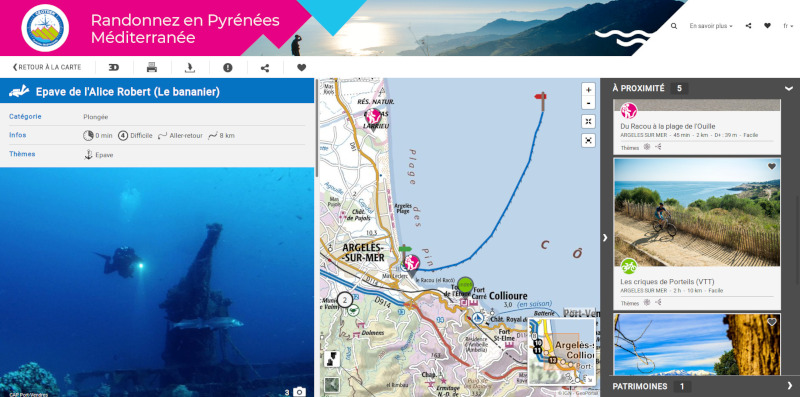
Discover trekking in Catalan country
October 2018
Big event : tourism office intercommunal Pyrénées Méditerranée (OTI) and communes communauty Albères-Côte Vermeille-Illibéris will reveal their new Geotrek website, on October, 27th and 28th during the 3rd meeting of Trekking in Pays Catalan.
This website dedicated to nature activites will show the wealthy terrestrian trekking diversity (hiking, mountain byke, biking, riding) in the country… but won’t be limited to it.
Indeed, l’OTI have decided to deploy Geotrek solution to the following activities : trail, diving and nautic activities.
As a reminder, Pyrénées Méditerranée area is an amazing sea and mountain land in the middle of the nature, et includes 3 nature reserves, almost unique in France.
Then Geotrek will allow the hikers to discover this land and its heritage, helped by a real digital guide.
Firstable with the website rando.tourisme-pyrenees-mediterranee.fr then thanks to the mobile application available in the coming months.
To answer quickly to this project, l’OTI has requested the society Makina Corpus which has show reactivity and agility to new practices not in the Geotrek product DNA.
Geotrek and the opendata
June 2018
The Alpes de Hautes-Provence Department has created a Geotrek and Opendata page on its RANDO site. Its showcases the Geotrek tool, the opensource software and the Opendata approach in which the Alpes de Haute-Provence department is involved.
Moreover, the Departement shared on the Open Data Sud website the entire network PDIPR04 (6500 km of trails), the whole signage furniture for trails as well as the hiking trails from www.rando-alpes-haute-provence.fr.
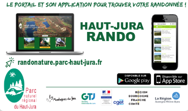
The PNR Haut-Jura in the stores
June 2018
Since the beginning of May 2018, the mobile application “Haut Jura Rando” of the randonature site is available and downloadable for free the platforms:
Google Play : https://play.google.com/store/apps/details?id=com.jura.rando
App Store : https://itunes.apple.com/us/app/haut-jurarando/id1373636894?l=fr&ls=1&mt=8
Geotrek at ESPARC
June 2018
The Europarc Congress (ESPARC) was organized in Cangas de Onis in the Asturia. It brought together more than 150 managers of protected natural areas in Spain for three days. It was a great opportunity to introduce the Geotrek application and its positioning in French parks.
Several workshops highlighted the strengths of the Geotrek application: the issues surrounding the sharing of actions in the territories, the role of associations and companies in the management of itineraries and the use of new technologies as a tool for improvement of efficiency. Makina Corpus presented Geotrek under the theme “Management, maintenance and promotion of hiking trails: the experience of National Parks in France”.
The andience brought together park managers, technical officers and specialists in the environmental consulting. The rewarding exchanges showed a strong interest of the Spanish parks for Geotrek.
Read the full article on Makina Corpus’ blog
Geotrek of the National Regional Parks of PACA region
April 2018
The Chemin des Parcs portal offers 1900 km of walks punctuated with 1400 points of interest at the option of 198 different routes. And this through 7 Regional Natural Parks in the PACA region. The pooling offered from the open source application Geotrek appealed for the enhancement of the overall offer of routes in this great territory. Each park has access to the application and enhances the common database, which has facilitated collaboration between the parks.
Read the article (in French): http://www.voyageons-autrement.com/chemin-des-parcs-les-beaux-fruits-de-la-collaboration.
Geotrek 2018 Horizon
January 2018

By 2018, Geotrek accompanies you in all your tourism activities by promoting hiking, heritage, French terroir … We remain close to you!
First feedback on Geotrek 2017 meetings
January 2018
On 19 October 2017, for the second year in a row, the Geotrek Meetings brought together users of this open source application dedicated to the management of the hiking offer.
This rich day of exchanges had provided the opportunity for an overview of new features, as well as feedback on the activity of the community and allowed to identify the development projects of the tool.
Discover Rando tec-tec
October 2017
The National Park of La Reunion has just launched its Geotrek-rando portal: http://randotectec.reunion-parcnational.fr.
Discover the National Park and travel to the heart of the “Pitons, circuses and ramparts of the island of La Reunion” World Heritage.

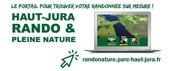
Discover the plateform HAUT-JURA, RANDO & PLEINE NATURE
July 2017
The Regional Nature Park of Haut-Jura launches its new platform http://randonature.parc-haut-jura.fr, created with Geotrek and dedicated to hiking routes and outdoor activities in the park.
The website highlights hiking and interpretive trails and offers several services such as accommodation, catering spots, etc. The Park innovates by having made the choice to integrate as POI all the signposts present on the routes which has the advantage of guiding the hiker more accuratly. More details are presented on the park’s website.
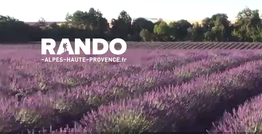
Discover Rando-alpes-haute-provence.fr
July 2017
The Departmental Council of the Alpes de Haute-Provence has just launched its new website www.rando-alpes-haute-provence.fr, realized with Geotrek and dedicated to hiking routes in the department.
This portal is dedicated to five hiking activities: pedestrian, equestrian, mountain bike, bike and trail.
The site currently offers the first fifty hiking routes. The offer will be evolving with the regular introduction of new circuits.
For more information, read the article on Conseil départemental website or read the press release.
See also the portal launch video:
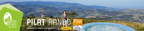
Discover Pilat Rando
July 2017
The Regional Natural Park of Pilat has just launched its portal Geotrek-rando: http://pilat-rando.fr.
It focuses on hiking with 72 circuits online at the moment. But it also contains 2 cycling circuits, 2 mountain bike circuits and 2 equestrian circuits and others will be added soon.
Geotrek at the Mountain Business Summit of Tarbes
July 2017
Makina Corpus has presented the Geotrek application at Mountain Business Summit of Tarbes.
During the 5 July 2017 conference on the challenges and expectations of the connected mountain, it was the opportunity to discuss the role of Geotrek in the management of natural areas through professional features dedicated to professionals, and the enhancement of territorial assets to a wide audience.
Find more details of this first edition on Madeeli website.
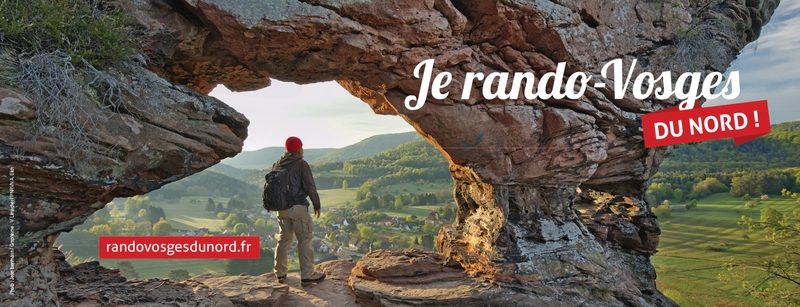
Discover Rando Vosges du Nord
July 2017
The Regional Natural Park of the Vosges du Nord has just launched its Geotrek-rando portal: http://www.randovosgesdunord.fr.
It was realized in partnership with six Tourism Offices currently displays:
- 3 languages
- 44 routes over 700 km + 4 to follow
- 100 POI
- 400 photos
- 15 videos (via the medieval castels’ routes)
It is also used to feed the national IGNrando portal thanks to the API available in Geotrek.
Geotrek Haut-Jura in the IGN Magazine n°86
April 2017
As of now, the Haut-Jura Natural Regional Park uses Geotrek. The IGN goes back on this deployment and states that “Geotrek has gradually became a national reference in terms of management of the hiking offer and is part of a philosophy of sharing”.
The whole article to read on page 13 of IGN magazine n ° 86.
Discover Normandie-Maine destination
April 2017
The Normandie-Maine Regional Nature Park launched at the end of March 2017 its Geotrek-rando portal (http://tourisme.parc-naturel-normandie-maine.fr) : accommodation, catering spots, key websites, itineraries, events …
By giving access to all the services offered on the territory, the website makes easy the formalities of stays’ and/or visits’ arrangements, and brings down the administrative borders. It then enables the whole tourist’s offer of the Park.
See full press release on the PNR website..

Rando Guadeloupe celebrates its two-year anniversary!
January 2017
Since the launch of the website in December 2014, more than 73,000 visits have been recorded. Most of the Internet users come from Guadeloupe (44%) and Metropolitan France (37%). Thirty-four treks are currently available online, but the site is likely to evolve, both in terms of content and technical options.
New logo, new content, mobile application, translations, partnerships … To learn more about the evolution of the portal, see the article on Guadeloupe National Park website.
Website "Chemins des parcs" and "Rando Grands Causses" has been revamped!
April 2016
PNR PACA and Grands Causses chose Geotrek‑Rando V2 to reinvigorate theirs trek and tourism platforms. This new collaboration with Makina Corpus provides them a better valuation hikes practices and improve the image of their territory.
The Grand Tour des Écrins
March 2016
Geotrek becomes an essential tool for soft multi-day trekking. The Écrins national park uses it within the context of the creation of Grand Tour des Écrins. This website comes with a mobile application, available on Android and iOS. Eco-tourist routes of Grand Tour des Écrins are addressing sportsmen as as famlies. Six multi-day treks are actually available on the website to discover the protected spaces of the highest Alpes du Sud massifs, in addition of more than one hundred of treks already available on Rando Ecrins, dedicated to daily trekking in the national park.
The National Parc of Cévennes and its new touristic platform
February 2016
The National Park of Cévennes officially announced the release of its touristic platform. Geotrek‑Rando V2 new design enhances accessibility of the entire Park offer (outdoor activities, heritage, events, accommodations, restaurants,…).
Happy New Year 2016!
January 2016
The community and Makina Corpus Geotrek team wish you a very Happy New Year 2016. Get ready for adventure and discovery with Geotrek!